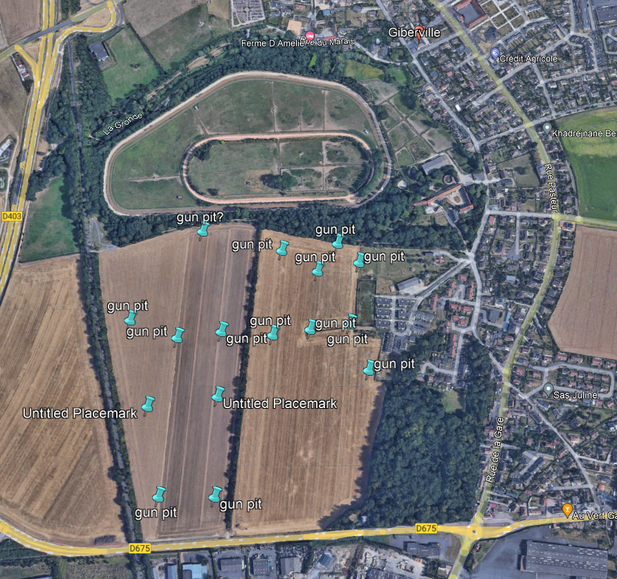
Finding a map referenceSometimes the War Diary will give a map reference for a gun position, but not always. The 9th Medium Regiment RA took over gun positions in Giberville from 77th Medium Regiment RA. Fortunately their diary did give a reference for the gun positions: map square, 0867. You can find the location using a wartime map.
|
Use the Coordinates Translator to convert to a modern map reference.Visit http://www.echodelta.net/mbs/eng-translator.php to convert the wartime reference to a modern map reference and Google Earth image. Beware that these conversions can be a little inaccurate but they do give the approximate area. Always back up by using a wartime map/reference and matching up to a modern map.
|
Aerial PhotosJust occasionally, an aerial photo matching the date that the regiment was present, will reveal evidence of the location of gun positions. Remarkably, here in Giberville, the gun pits and slit trenches can be found on the aerial image. The 4 gun pits for each Troop are clear to see!
|
- Home
- 8th Buffs
- Training Boston
- Photographs: North West Europe '44-'45
- Photographs: personalities
- Roll of Honour
- Wounded
- Photographs: Then and Now
- Normandy
- An appeal
- Operation Vitality
- Operation Vitality (9th Medium War Diary)
- Weert Then and Now
- A Sad Accident
- Winterswijk Liberation
- Uniform and dress in action 44-45
- Nominal Roll
- Tank Busters
- RA Tracer Cards
- Honours and Awards
- Battles
- New Page


